Monday, 8 July 2013

...D-Day approaches

This was our last training event prior to the big off - four days in the Lakes for altitude and gradient walking. We stayed in accommodation just outside Keswick and, on day one, had a pre-emptive attempt on Skiddaw. It was wet, very wet, soaking wet, and so when we got into the cloud at about a 1000ft and could see nothing we bailed out.
The following day we did something a little less ambitious and walked the plateau from Stonewaite to Watendlath (cafe closed due to - rain) and back. Again it was wet, this time only above the cloud not as before above and below. Waterproofs and boots tested to the extreme. It also allowed is to gauge how and what would be difficult to access in the wet i.e. cameras from stay-dry bags, and what we did /didn't need to carry.

 The next day was better for the weather - at least it only rained a little, not at all really compared to the previous days. This time we had some lakeland virgins with us so took an easy route doing High Crags and Cat Bells from Little Town and exiting down the usual 'up' path. It was like a tube station in the rush hour - bodies of all descriptions and all manner of dress everywhere - children, kids, dogs and the odd granny not to say just the odd!
 It must have been an easy day 'cos we walked to Keswick and back in the afternoon just for something to do.
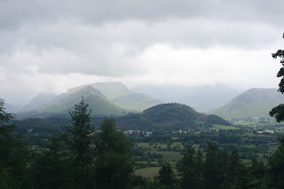
On our last day we took the Lakeland virgins off to do the Buttermere circuit. What a lovely day - finishing of with a nice hot brew in Buttermere. Crowds were a minimum, views were wonderful, weather was kind and it was nice to be out for a stroll doing nothing other than passing the time. I expect the swimmers in the lake had a good day too.
training...

No big events, just lots and lots of 'get out and walk' jobbies. Some of us even ran a little bit!

more trainin...

This time we went for distance to try and gauge our mph. We undertaken a 14 miles stretch of the Llangollen canal around Ellesmere. Snow was still on the ground in places, but it didnt feel like it with the calories we were burning off.
We took lunch, but made such good time we were back home again to eat it. We did the 14 miles in just on four hours - which is a rate of around 3.5miles an hour. We were pushing it, and it was on the flat, so the message is 1) we can do that sort of mileage with ease 2) blister count was low 3) we know we can produce this turn of speed if required.


Again, amazing what you see out and about.

(missing off the g was deliberate)

training April

Following the Potter we next did a day of walking part, not all, of the Sandstone Trail. Really it was just a case of getting out and re-stretching the legs with the sole purpose of trying to get a few more miles in the legs.

What you can't see here is just how windy a day it was - in some places a howling hoolie. Spring was just about starting - a few chiffchaff were about, lapwing were in the fields, and wood anenome's a violets were flowering.

A one point we were walking alongside a water drainage ditch recently cleared. In amongst the debris was the biggest horse-shoe seen to date. I took it home thinking /hoping it was from some long-gone Suffolk punch working the fields.
 It's amazing what else you see in out of the way places.

Sunday, 10 March 2013

More fitness training...

...the (17th) Pontesbury Potter. A tough 13 mile challenge using lesser know paths and tracks around Pontesbury hill and surrounding area. With cold, snowy, conditions forecast we set out on what we thought was going to be a wet day. Windy and a touch cold, but wet it was not - except for underfoot which in places was a quagmire after a couple of days of rain. Pontesbury Hill was a bit of a 'puffer' as they placed it on route in the last mile or so of the walk - hence the straggle right.

But where you go up you also come down. The day was useful in terms of stretching legs, expanding lungs, and learning to eat / drink on the move. We finished the walk in 4 hrs 40 minutes which puts us at about 2.5 miles /hour. This will be useful for planning when out on the C2C proper.
According to the Potter organisers a finish in under 5 hours qualifies one as a 'Strong Walker' (as in preference to Average Walker or Stroller).

Next scheduled event is an assent of Cader Idris.

Preparations

With about four months to go till the off things have been undertaken quietly in the background. In addition to checking and buying more kit - new boots, waterproofs, waterproof rucksack liners and plenty of Compeed - we have been turning to fitness.
Not long long ago some of us managed to grab a few days in the Lakes where we had time to check out the start of the walk at St Bees (also checked out the car-parking charges for later). It wasn't a great day for the weather, but it was dry. We took a gentle stroll to the lighthouse and back (a couple of miles) just so we wouldn't look like idiots on the day and not know which way to go. One thing that you cannot get from the picture is the smell. An on-shore breeze bought wafts of cormorant guano as they use the cliffs on which to nest.

Later a summit of Haystacks was performed - one for the joy of it - but second to get the lie of the land on what would be our first two days of walking. The picture left shows the view west back to the coast. The wet bit in the middle of the shot is Ennerdale Water where the C2C takes in the whole southern bank of the lake.
The next shot shows the valley floor with Black Sail Hut off to the left.

The following day it snowed - horizontally - so we just walked for an hour and back through the blizzard up one of the paths to Helvellyn. This was simply to 'get out'. When actually walking the C2C we'll have to put foot to path whatever the weather.

Thursday, 3 January 2013

Oops - better get this bit right

From the Wainwright Society web pages.
 
Coast to Coast Walk - Navigational Errors
From Ennerdale to Borrowdale
In response to a request from the Mountain Rescue Association, we have been asked to report that a number of Coast to Coast walkers are making serious navigational errors just beyond Black Sail Youth Hostel, and so fail to turn up at Loft beck for the correct route. Mountain Rescue Teams have been called out on numerous occasions to respond to walkers getting into difficulty on this leg between Ennerdale Bridge and Rosthwaite. The following map serves to re-iterate the correct routing beyond the Black Sail Hut and walkers are advised to pay extra attention to this point of the walk.